Wapiti Flight 402
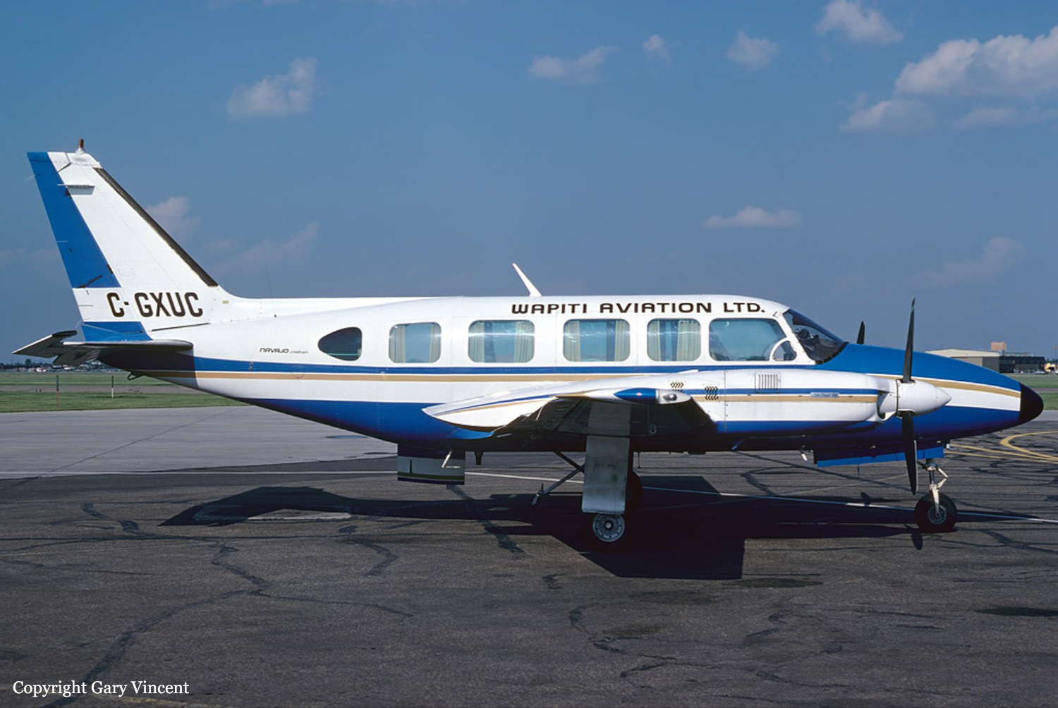 Flight 402, Piper Navajo Chieftain before crash
|
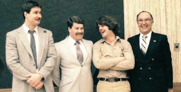 The Four Survivors - (L to R: Erik Vogel, Scott Deschamps, Paul Archambault, Larry Shaben)
|
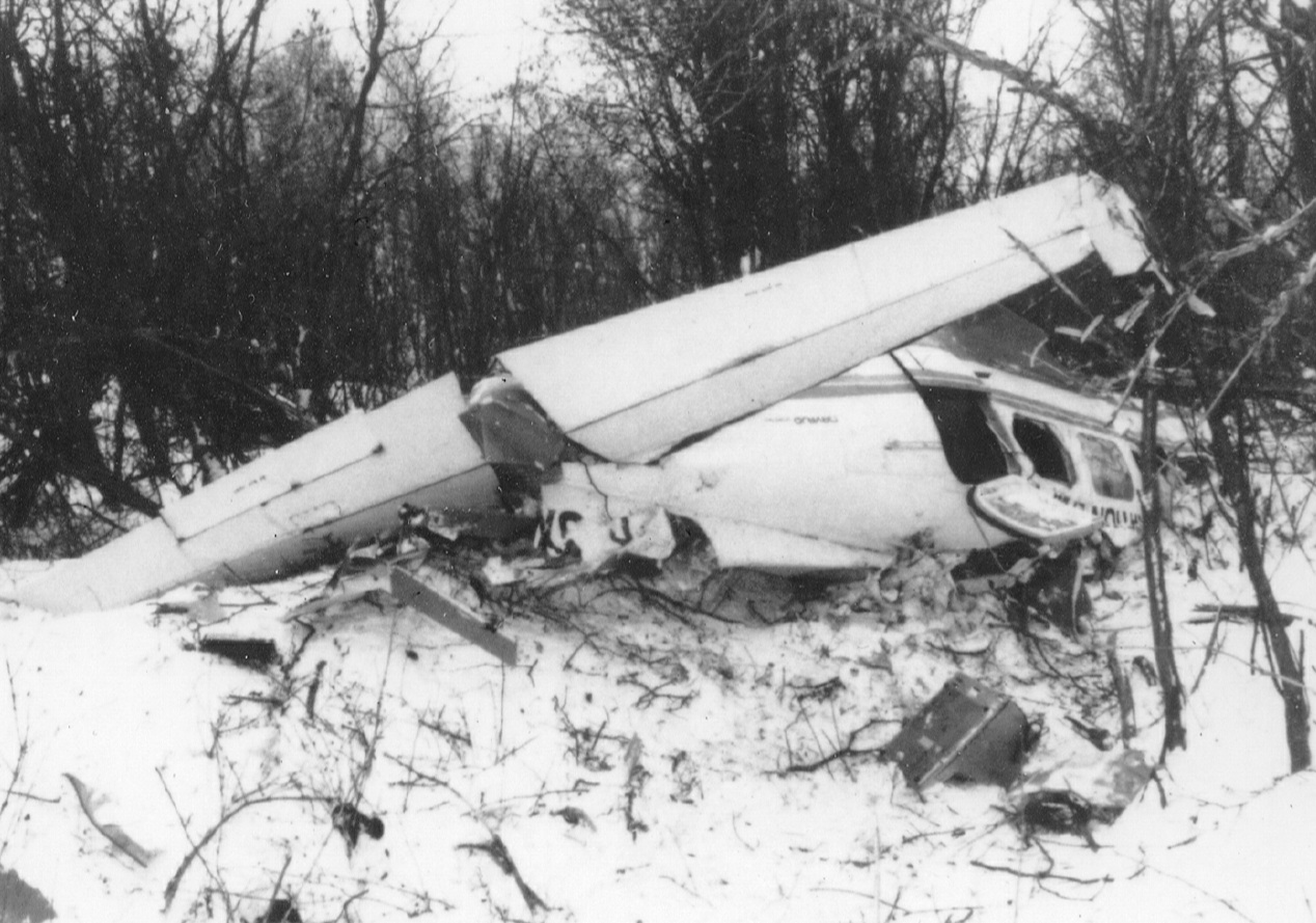 Wreckage of Flight 402
|
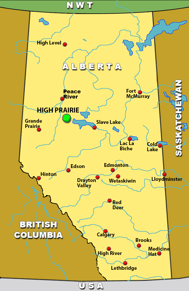 Map of relative Alberta, Canada Airports with High Prairie highlighted in green
|
Narrative: Commuter plane crashed on approach to High Prairie (Alberta) airport
The aircraft was on a night IFR flight from Edmonton to Peace River, Alberta with a planned stop at Hight Prairie. While cruising above cloud at 8500 feet, the aircraft was cleared to descend
to 7000 feet, and the pilot commenced an en route descent towards the High Prairie Airport. The descent was continued in cloud to below the minimum obstruction clearance altitude.
While still in cloud at 2850 feet asl, the aircraft struck high terrain 20 miles east southeast of High Prairie. Six passengers perished; the pilot and three other passengers survived.
Related links:
Official Wapiti Crash Report (English version 2nd half of document)Book: "Into the Abyss" - Carol Shaben
MSFS2020 Download scenery file for High Prairie NDB
Flight Information:
Suggested Aircraft:
Piper Navajo Chieftain or similar with at least one ADF radio.
Weather:
Nighttime with light snow - 800 ft scattered, ceiling 1,500 ft broken, 8000 ft overcast.
Flight Plan:
When planning your flight you can choose your own navigational options. If you wish to follow the challenging flight of the actual aircraft, disable our hide your gps and perhaps don't even
add a flight plan to the simulator. If not adding flight plan, you will have to manually enter the flight plan information into SPAACARs so that your flight hours can be logged.
The pilot actually had only one working ADF. His flight plan was from Edmonton Municipal Airport, no longer exists, so we'll start at Edmonton Intl, which is close to the old airport location.
From there he tuned in Whitecourt VOR and followed that until he picked up High Prairie NDB and begun following that. He then monitored the Swan Hill NDB until he passed Swan Hill where he began his
descent into High Prairie. Since this resulted in his crash because of high terrain beyond Swan Hill, you may want to maintain a safe altitude until you reach High Prairie NDB, then do a circling
approach to the airport.
If you're flying MSFS2020, you can download the scenery file from the link above that I created to replace the High Prairie Airport NDB that is no longer there.
It's probably best that you look at your own flight planning documents to get a better layout of the airports, but most are on a direct flight route from Edmonton to Peace River, except for Whitecourt,
which will take you west of the direct flight path. I found that the most direct flight is to fly on a 305 degree heading from Edmonton until I can pick up the Swan Hill NDB. Follow Swan Hill NDB
until you can pick up High Praire NDB. Make your circling approach to land at High Prairie. Then you can take off and fly the final leg to Peace River where you can use an ILS approach.
Here's a summary of the navigation aids for this flight:
Edmonton VOR 114.1
Whitecourt VOR 112.5
Swan Hill NDB 251
High Prairie NDB 406
Peace River VOR 117.2
For those of you flying simulator other than MSFS2020, you can tune in the Swan Hill NDB and the Peace River VOR. High Prairie airport is along a line between Swan Hill and Peace River, approximately 60 miles DME from
Peace River. You can always do a clear weather run to get the layout of things before trying it in the actual weather that existed when the crash occurred.
Remember to turn Off Econ Mode on SPAACARS before flying this flight or it will only record the flight from Edmonton to High Prairie and not the second leg to Peace River.
| Flight Code | Origin | Destination | Distance(NM) | Orig Airport | Dest Airport | Rwy Lgth |
| 903117 | CYEG | CYPE | 220 | Edmonton Intl | Peace River | 4970 |
Optional flights to airports serviced by Wapiti
Note: Take notice of the runway lengths, especially Grand Cache, which is a dirt strip, to ensure you have a plane capable of landing there.
| Flight Code | Origin | Destination | Distance(NM) | Orig Airport | Dest Airport | Rwy Lgth |
| 903118 | CYEG | CYZH | 126 | Edmonton Intl | Slave Lake | 5565 |
| 903119 | CYZH | CZHP | 58 | Slave Lake | High Prairie | 3896 |
| 903120 | CZHP | CYPE | 60 | High Prairie | Peace River | 4970 |
| 903121 | CYPE | CEB5 | 34 | Peace River | Fairview | 3497 |
| 903122 | CEB5 | CYQU | 56 | Fairview | Grand Prairie | 8482 |
| 903123 | CYQU | CYGN | 162 | Grande Prairie | Grande Cache | 1871 |
| 903124 | CYGN | CEC4 | 103 | Grande Cache | Hinton/Jasper-Hinton | 4498 |
| 903125 | CEC4 | CYZU | 86 | Hinton/Jasper-Hinton | Whitecourt | 5778 |
| 903126 | CYZU | CYYC | 192 | Whitecourt | Calgary Intl | 13993 |
| 903127 | CYYC | CYEG | 132 | Calgary Intl | Edmonton Intl | 10941 |